Add your promotional text...
A Hiker’s Tale — My Day at Big Pocono State Park, Tannersville, PA
Discover stunning panoramic mountaintop views, rugged landscapes, and serene woodland paths
5/8/20243 min read

A Hiker’s Tale — My Day at Big Pocono State Park, Tannersville, PA
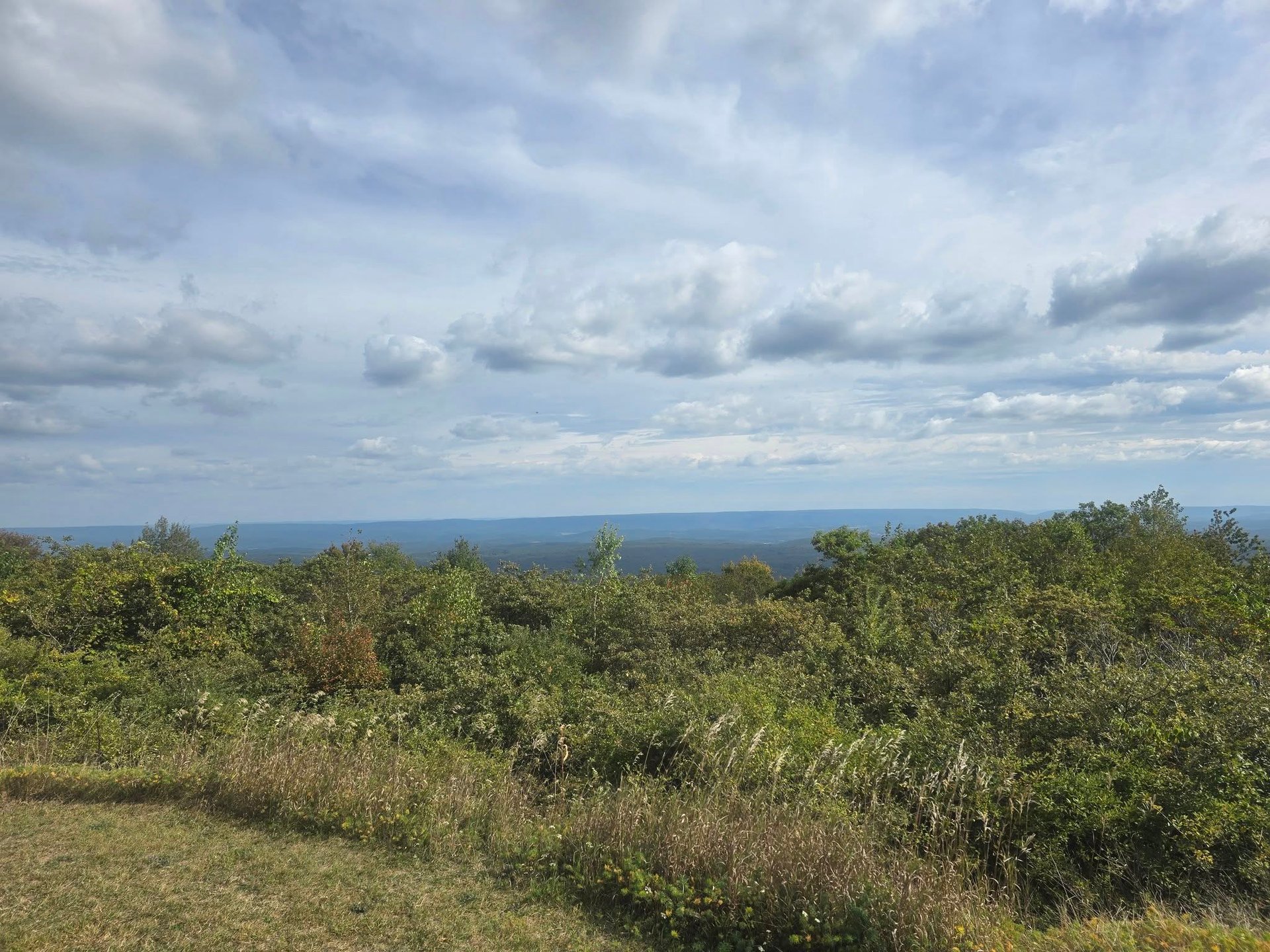
If you told me a few years ago I’d find myself standing atop a mountaintop, gazing out over three states — Pennsylvania, New Jersey, and New York — I might’ve laughed. But that’s exactly where I ended up this past weekend, after hiking the trails on top of Camelback Mountain at Big Pocono State Park. The experience was part peaceful, part exhilarating, with enough terrain variety to satisfy seasoned hikers and curious newcomers alike.
What I Saw & Loved
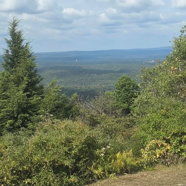
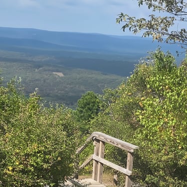
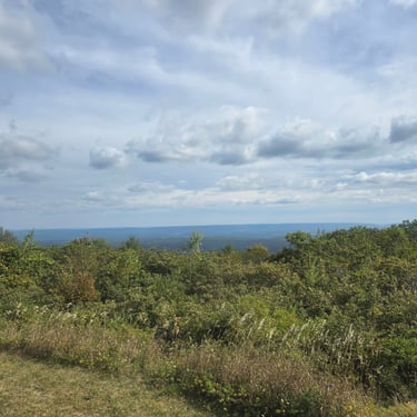
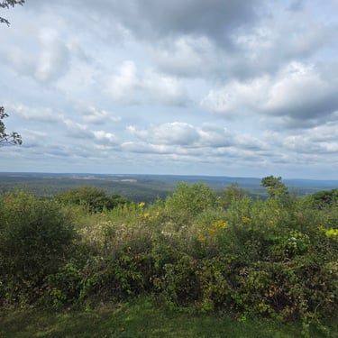
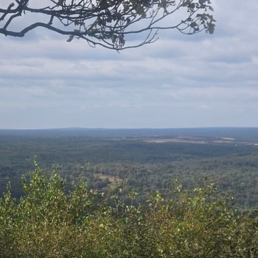
From the summit, the views were expansive: it was a clear day and I saw sweeping ridgelines, forested slopes, and distant horizons crossing state lines
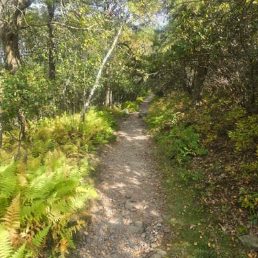
The trails wind through a blend of woodland, rocky outcrops, and cliff-edge overlooks. On the easiest loop, I saw forest ferns, old-growth trees, and scattered boulders — rugged but beautiful terrain.
On one ridge, the height and openness of the summit make the park feel wild and exposed in a way that belies how accessible it really is.
The summit also offers picnic areas (tables, grills, restrooms), where I was able to relax with a simple lunch and just soak in the views.
The Trails: What I Hiked (and How Hard It Was)
The park has about 8.5 miles of trails — but don’t let that small number fool you: because the park sits on a mountain summit, many trails climb and descend steeply, and things get technical.
Here are the main ones:
Indian Trail - 1.3 mi, loop - Easiest
Calm, scenic — a nice introduction to the park. The eastern-cliff vista was worth every step. I did need to watch my footing a few times; the trail is rocky.
South Trail (plus optional Upper Loop / connectors) - about 3.0 mi total (loop/connector) - More difficult / moderate-difficult.
Woods, slopes, and two scenic overlooks. I felt my legs working — there are some steeper sections, and the ground is uneven.
North Trail and North Trail Lower Loop - 1.0 mi + 3.2 mi (connector/loop) - Most difficult
The steepest and most rugged terrain. The lower loop connects to the southern slope; good for hikers seeking a challenge. I’d only recommend this to confident, well-equipped hikers.
Short connectors (e.g. Vista Trail, Scout Trail) - Very short (0.1 mi or 0.09 mi) - More difficult to moderate
Useful for linking trails and reaching viewpoints, but terrain is uneven.
My take: I started with Indian Trail — calm, scenic, rocky but manageable. Then I ventured down part of South Trail to hit a couple of overlooks. The rockiness and incline made it a solid workout; I was glad I wore sturdy hiking boots and brought trekking poles. If I were less sure-footed, I’d skip the North Trail entirely.
Getting There, Parking & Practical Info
Address: Camelback Rd, Tannersville, PA 18372.
Access: The main entrance comes via PA-715 and Exit 299 off I-80.
Parking & Trailheads: The summit drive leads to Parking Lot #2, which is a convenient spot for summit access or to eat and take in views. For trails, many people use Parking Lot #4 (via one-way Rim Road just before the summit) — from there you can access Indian, South, and North trails. Some connectors/trails also start near Parking Lot #3.
Facilities: There are picnic areas (with tables, charcoal grills, restrooms), and some are ADA-accessible (Parking Lot #2 and #4 picnic restrooms/parking).
Fees & Access Season: There is no admission fee (free to enter).
Season & Hours: The park is open from spring through fall. It closes in early December and typically reopens the first week of April. When open, it’s from sunrise to sunset.
Weather & Conditions: Because the park is at the top of a mountain, it can get windy and cooler than the valley even in summer. The terrain on many trails is rocky, uneven, and sometimes steep — I’d strongly recommend good hiking shoes or boots, and trekking poles if you have them.
My Personal Reflections — Why I’ll Return
There’s something relaxing about standing on a mountaintop and seeing far beyond your immediate surroundings. At Big Pocono, the split between easy, gentle trails and rugged, demanding slopes gave me a real sense of contrast — from tranquil forest loops to pulses of leg-burning uphill.
I came for views, but I stayed for the variety: the quiet of the woods, the crunch of leaves underfoot, the wind at the summit, and those glimpse-moments over distant states. The picnic tables after a good hike tasted like earned victory.
If I were bringing friends with mixed hiking experience, I’d recommend doing the Indian Trail + maybe the easier portion of South Trail for a chill half-day. If I were solo and feeling adventurous — I’d aim for the full North + South circuit.
For more hiking tips, beginner guides, outdoor gear advice, and trail recommendations, be sure to explore more articles on Explore Trailways. Happy hiking!
Receive email notifications of new posts, trail tips and updates straight to your inbox.
Contact us at:
Follow us at:
contactus@exploretrailways.com
© 2025. All rights reserved.